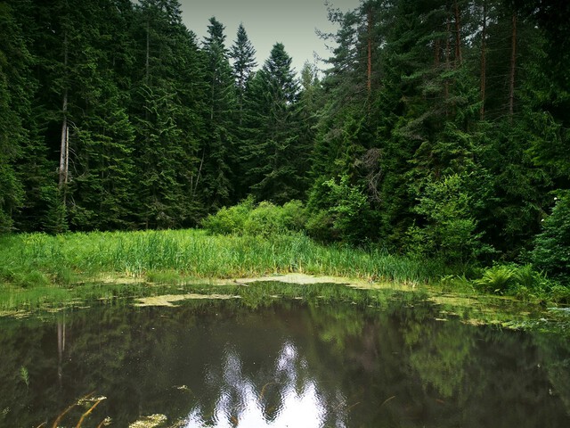


A forest lake located on the slopes of Malnik and Czarny Garbów, north-east of the center of Muszyna. The word "thresher" used in the name is somewhat misleading. It means a marshy and marshy place. When we get there, we will see a small lake with a dark, almost black depth, in which the towering fir trees and a patch of sky are reflected like in a mirror. Czarna Młaka is a mountain lake unique in the Beskids, which was created as a result of a landslide. A landslide blocked the outflow like a dam and gave rise to the reservoir. This event happened eight or nine centuries ago. A similar lake can be seen a few kilometers from Rytro on the slopes of Radziejowa. It is much more difficult to access than Czarna Młaka. There will be no more such places in Beskid Sądecki. At the time of its creation, Czarna Młaka had an area of nearly two thousand square meters. Currently, the depth of the plant-free water is ten times smaller and is only three meters deep. The lake is disappearing and this is a natural phenomenon known as ecological succession. Plants systematically overgrow its edges, and the bottom is slowly covered with fallen leaves. The layer of sediment that grows each year gradually shallows the reservoir. In a few hundred years, Czarna Młaka will turn into a bog filled with peat. Thus, unique communities of plants and animals inhabiting such lakes will disappear from here. The breeding place of the local amphibians: the toads, the common frog and newts will be lost. No less important will be the loss of the water reservoir that regulates and maintains humidity in the surrounding forests.
Czarna Młaka has become a subject of active protection. Thanks to the funds obtained by the Municipal Office and the Health Resort Commune of Muszyna, it was possible to remove mud and plants from part of the bottom. Ecological succession was temporarily halted and the amphibians regained their breeding sites. On the banks, a pier has been built, thanks to which you can comfortably observe life in the water. For the needs of tourists, a roofed shelter, information boards, litter bins and parking spaces have been arranged. A well-marked route from Muszyna and Powroźnik leads to Czarna Młaka, which can be covered on foot or by bike. The hike to the lake from Muszyna takes less than an hour. There is an overwhelming silence waiting for tourists, broken only by the buzzing of insects and the voices of birds. The crowns of hundred-year-old firs, the tops of which reach thirty meters, are reflected in the depth of the water. The northern shores of the reservoir are covered with rushes of cattail, horsetail and sedges. A thicket of plants covers ducks, and if you peek into the water from the pier, tadpoles of frogs and newts will appear. On hot nights you can hear concerts of toads, small toad-like amphibians. The bridge leads to the site of law-protected orchids called white knees.
Czarna Młaka has the status of a natural monument. Please respect our common good. Taking garbage with you, not burning fires, not tearing plants and not scaring animals. Attempts to "enrich" the lake with exotic species of aquatic plants or fish released into it are very dangerous for Czarna Młaka. Species of plants and animals that are not natural inhabitants of a nature monument pose a great threat to its functioning. A perfectly marked nature and tourist path with numerous information boards leads to Czarna Młaka. It is best to start the walk from the Chapel of Our Lady located on the right side of Grunwaldzka Street, going towards Krynica. The starting point is located several dozen meters after the intersection with the local road to Jastrzębik. The route runs steeply uphill on a concrete road and turns east after passing the last buildings. Right next to the dirt road from the clearing, a vast panorama of Jaworzyna Krynicka and the village of Powroźnik opens up. Then the trail enters a beautiful fir forest that stretches all the way to Czarna Młaka. In places, the swampy road leads uphill to the north-east. Black marks painted on tree trunks and information boards make it easier to find the path. After visiting Czarna Młaka, the further route gently goes north and joins the blue tourist trail. Going south, you can reach the Dubny peak cumulation. From here, the blue trail leads to the village of Leluchów, and the yellow trail to the village of Wojkowa. However, following the blue trail to the north, we reach Powroźnik, where the end (or the beginning, respectively) of the journey is marked by an information board placed next to the road.
Lack
3,3 km
Używamy plików cookies aby zwiększyć funkcjonalnośc strony oraz zbierać statystyki odwiedzin witryny.
Zaakceptuj i kontynuuj.