


Type of trail: cycling
Color: yellow (in Poland), yellow-blue (in Slovakia) yellow vertical signs with the trail logo on a green background
Length of the route: approx. 230 km
Maximum altitude on the trail: 1,049 m above sea level
The minimum height on the trail: 216 m above sea level
The difference in elevations: 833 m
Type of pavement: asphalt, dirt roads, paths
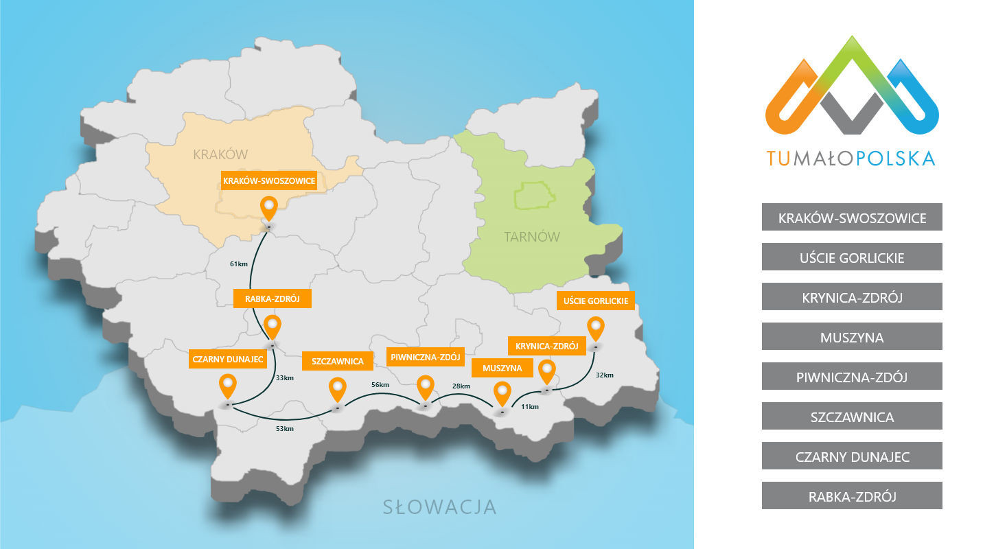
The course of the route:
The route connects the spa towns of the Polish-Slovak border Bardejovské Kúpele - Bardejov - Krynica-Zdrój - Muszyna - Piwniczna-Zdrój - Szczawnica - Vyšné Ružbachy - Starú Ľubovňu - Ľubovnianske Kúpele.
Description of the route:
The route runs through the picturesque gorges of the Poprad and Dunajec rivers, through the most valuable nature and landscape areas (national and landscape parks) and includes valuable monuments of wooden architecture, pump rooms and mineral water outflows. It gives the possibility of recreation for people with different exercise capacity and interests.
The smartphone application for the AQUAVELO route was prepared as part of the project. Mon "Health resorts of the Polish-Slovak borderland as a health tourism area recognizable in Europe - stage I - construction of a bicycle loop connecting the spa towns of the Poprad Valley". It allows each user of a bicycle route to download information about its course, parameters, distance to the nearest town, currently passed "attraction" with its description, distance to the nearest rental shop. It also allows you to plan the route through full information about individual sections, their length and degree of difficulty.
The application can be downloaded by CLICKING HERE.
Worth knowing:
When setting off on this route with the intention to travel to Slovakia, you need to equip yourself with helmets and reflective vests, as this is a necessary requirement on the Slovak side.
Używamy plików cookies aby zwiększyć funkcjonalnośc strony oraz zbierać statystyki odwiedzin witryny.
Zaakceptuj i kontynuuj.