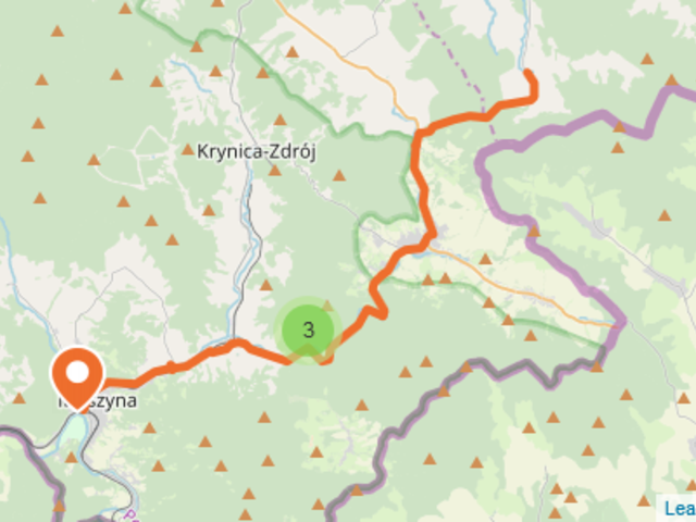


Type of trail: cycling
Blue color
Length of the route: approx. 71 km (all), section Muszyna - Izby 21.8 km
Maximum altitude on the trail: 287 m above sea level
Minimum height on the trail: 146 m above sea level
The difference in elevations: 141 m
Route details:
This trail leads through the border area, through various mountain ranges. It begins in Muszyna, then leads through Powroźnik, Tylicz, Krynica-Zdrój, Izby, Brunary, Uście Gorlickie, Gładyszów, Radocyna, and ends at the Long Pass, then continues through the Bieszczady Mountains to Krościenko on the Strwiąż River as the Subcarpathian bicycle trail (red signs ).
Używamy plików cookies aby zwiększyć funkcjonalnośc strony oraz zbierać statystyki odwiedzin witryny.
Zaakceptuj i kontynuuj.